Overview
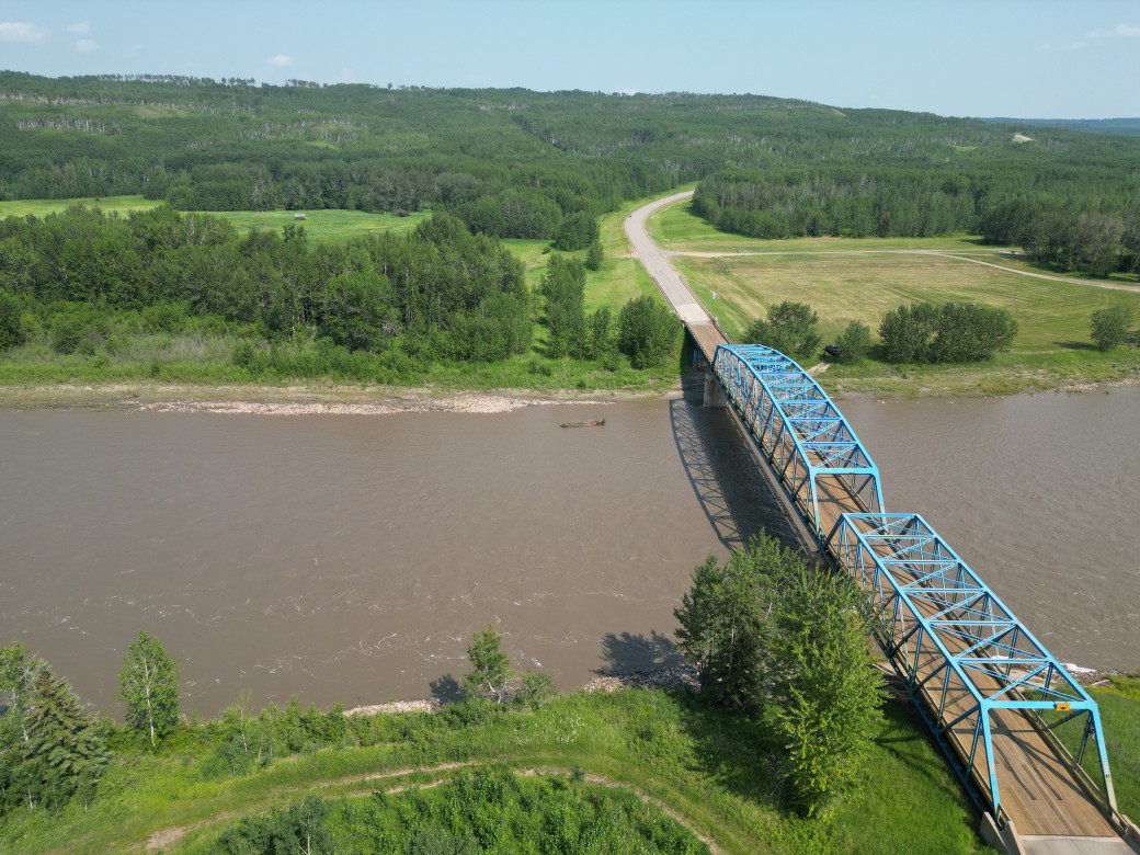
Highway 744 is a 2-lane highway, connecting Highway 676 to the south with Highway 49 (and the Town of Falher) to the north. Serving inter-regional travel, the Little Smoky River Valley crossing is important to the local community because it accommodates agricultural, resource and recreational access plus local travel needs.
The existing section of Highway 744 through the Little Smoky River Valley and crossing the river is increasingly at risk of temporary closure, with active slide locations on both sides of the valley.
The existing bridge across the Little Smoky River is nearing the end of its service life, and its replacement is part of the study process.
Benefits
This functional planning study is anticipated to be complete in 2025 to understand the most practical and feasible alignment for Highway 744 crossing the Little Smoky River Valley.
Conducting the study
Construction or reconstruction of a highway alignment through the Little Smoky River Valley is currently not on the provincial construction program. The need for further design leading to future construction will be determined based on the outcomes of this study.
CIMA Canada Inc. (CIMA+) is conducting the functional planning study, which will:
- assess conditions and constraints in the study area
- include stakeholder and public engagement to identify the concerns and interests of potentially impacted property owners within the study area and highway users
- assess the reliability, geotechnical stability, safety and cost of potential highway alignments and a new bridge
- evaluate improvements to the existing Highway 744 alignment through the valley and river crossing location compared with alternative alignment options within the valley
- develop an alignment plan that:
- provides the most appropriate design given the site constraints
- addresses geotechnical stability and safety, community interests, environmental and historical resources, drainage, and other impacts
- identifies access management needs and land requirements
Public engagement
The first public information session and stakeholder meetings were held in Girouxville on October 24, 2024.
Engagement materials can be found in the resources section.
Resources
October 2024 Information Session materials:
The following maps show the study location and limits.
Contact
Connect with CIMA+ for more information:
Hours: 8 am to 4:30 pm (open Monday to Friday, closed statutory holidays)
René Rosvold, P.Eng., Project Manager
CIMA+
Phone: 403-775-0100, ext. 7620
Email: hwy744.alberta@cima.ca