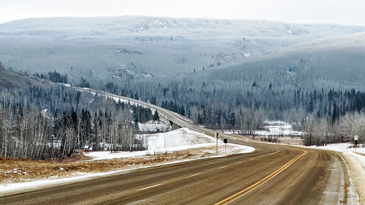
Highway 64, looking east across the Clear River Valley.
Overview
Highway 64 is a major 2-lane, inter-provincial highway and Alberta’s northernmost connection to the British Columbia border. A primary transportation corridor through Clear Hills County, Highway 64 links most of the county’s hamlets, and provides access to the Clear River Campground/Rodeo Grounds, local agricultural uses and resource activities.
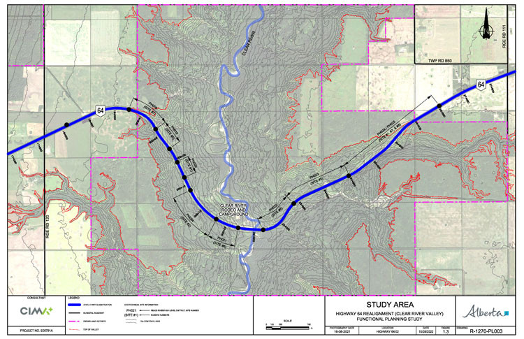
The existing section of Highway 64 through the Clear River Valley and crossing the river is increasingly at risk of major slides. Alberta Transportation and Economic Corridors is undertaking a functional planning study anticipated to be complete in early 2025, to determine the most practical and feasible alignment for crossing the Clear River Valley. The following maps show the study location and limits:


A functional planning study is the first step in understanding the needs for any future highway upgrading. The study was initially focused on identifying a new alignment for Highway 64 through the Clear River Valley. Following the initial review of new alignment alternatives and considering the stakeholder feedback received to date, the study was expanded to include the existing crossing alignment.
Construction or reconstruction of a highway alignment through the Clear River Valley is not on the provincial construction program at this time. The need for further design leading to future construction will be determined based on the outcomes of this study.
CIMA Canada Inc. (CIMA+) is conducting the functional planning study, which will:
- assess conditions and constraints in the study area
- identify the concerns and interests of potentially impacted property owners within the study area
- assess the reliability, stability, safety and costs of potential alignments
- evaluate improvements to the existing Highway 64 alignment and river crossing compared with a new alignment option across the valley
- develop an alignment plan that:
- provides the most appropriate design given the site constraints
- addresses stability and safety, community interests, environmental and historical resources, drainage and other impacts
- identifies access management needs
- identifies land requirements
Timeline
-
Winter 2022
Information gathering
- Stakeholder engagement (April)
- Technical investigations
-
Spring/Summer 2022
Alternative development
- Create new alignment alternatives
- Technical analysis
-
Summer 2022/Fall 2022
Compare new alignment alternatives
- Preliminary evaluations and pre-screening
- Stakeholder and public engagement (November)
-
Spring 2023
- Information gathering (existing alignment)
- Technical investigations
-
Spring 2023 to Spring 2024
Alternative development
- Create existing alignment alternatives
- Technical analysis
-
Spring/Summer 2024
- Compare existing alignment alternatives
- Preliminary evaluations and pre-screening
-
Summer/Fall 2024
Select preferred alignment
- Final evaluations
- Stakeholder and public engagement (October 2024)
-
Fall/Winter 2024
Finalize alignment
- Develop functional plan
- Confirm municipal support
Benefits
The study will help identify the most feasible alignment for Highway 64 crossing the Clear River Valley.
Public engagement
Public information sessions and stakeholder meetings were held in Cleardale on November 23, 2022, and October 23, 2024.
Engagement materials can be found in the Resources section.
Resources
October 2024 Information Session materials:
November 2022 Information Session materials:
Contact
For more information:
Hours: 8 am to 4:30 pm (open Monday to Friday, closed statutory holidays)
René Rosvold, P.Eng., Project Manager
CIMA+
Phone: 403-775-0100, ext. 7620
Email: rene.rosvold@cima.ca