Fire weather forecasts and observations

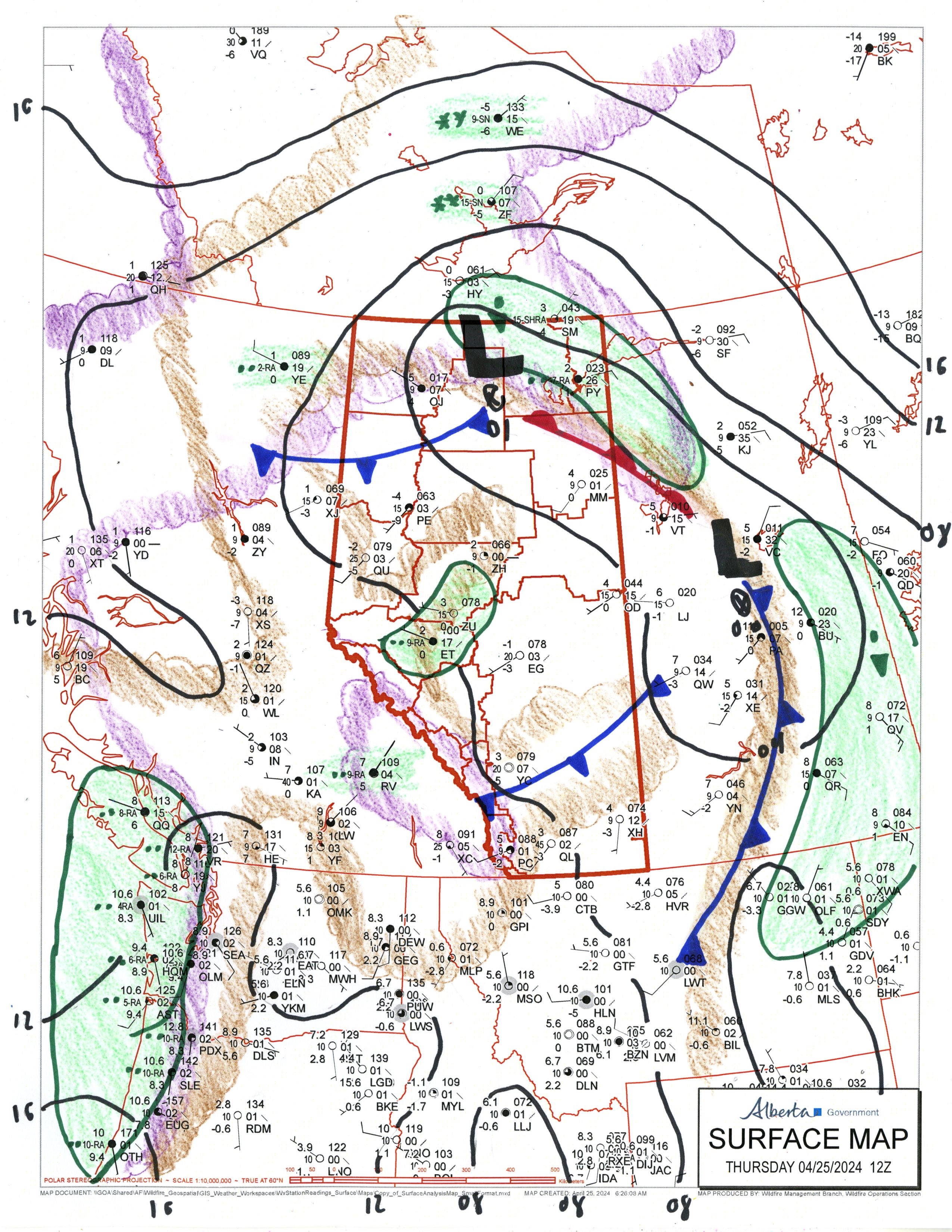
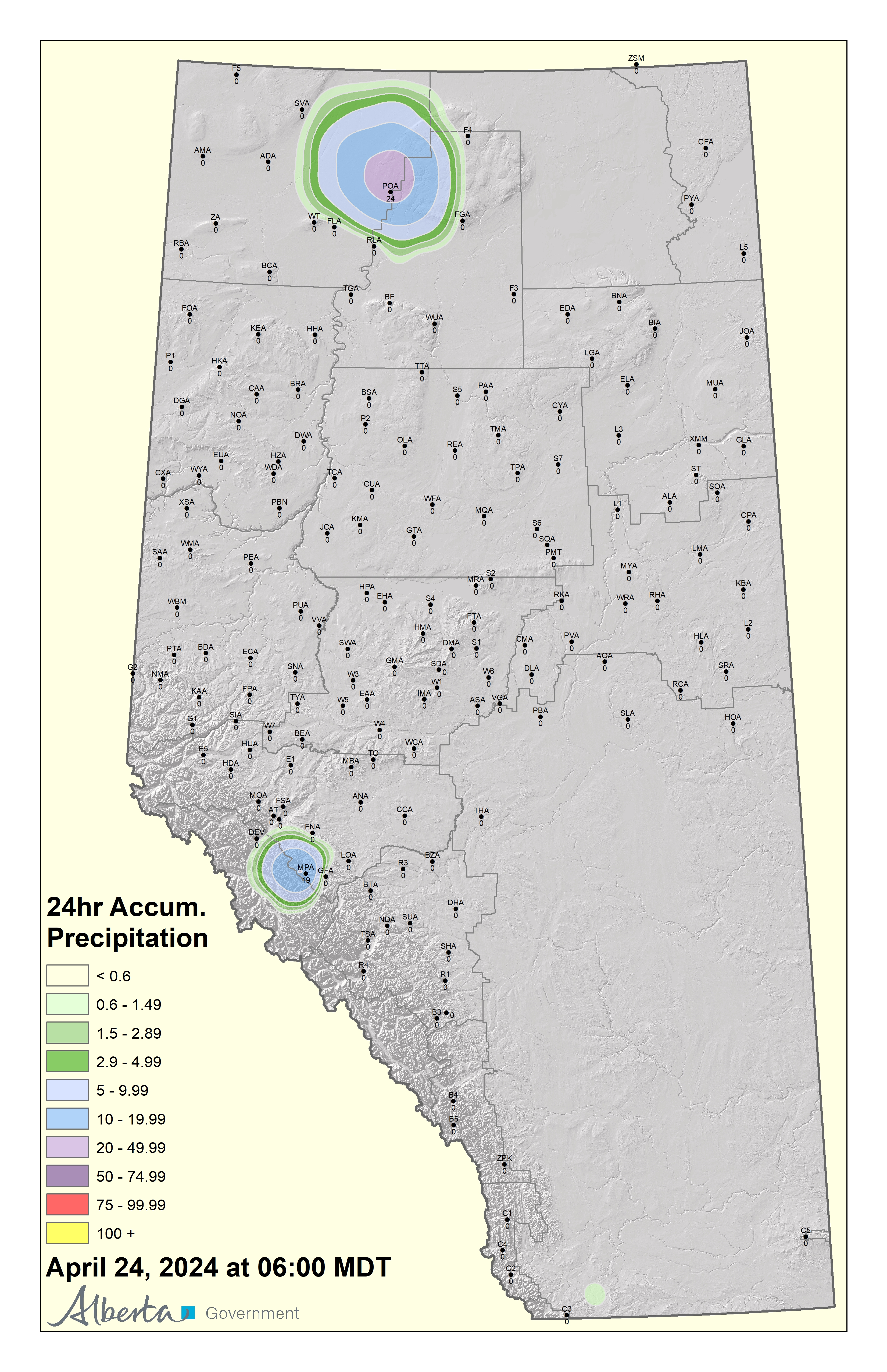
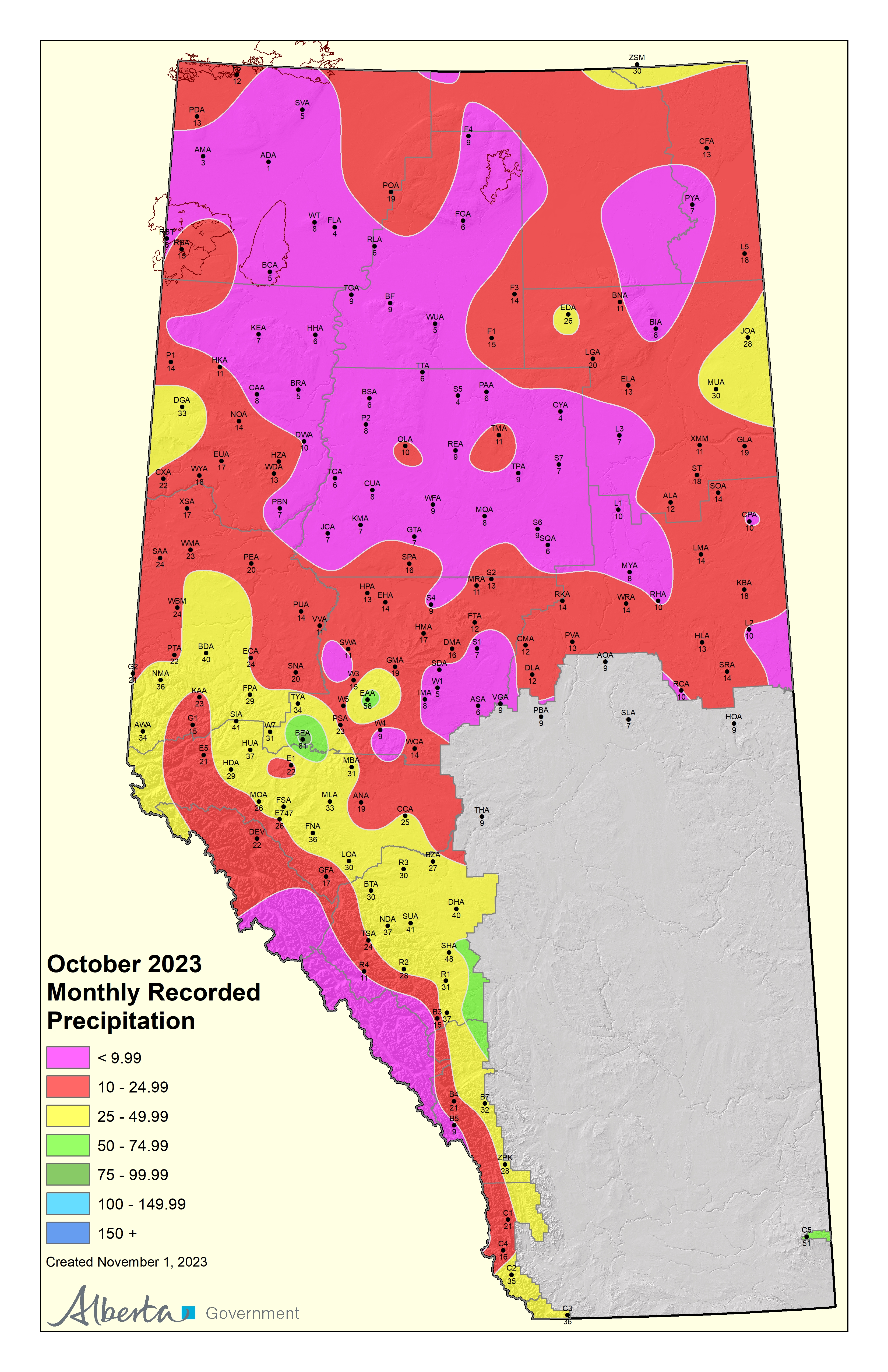
Find maps and data describing current and forecasted weather conditions, including precipitation and lightning.

Explore pages in:

Report a wildfire: If you see a wildfire in a forested area call 310-FIRE (3473)

Maps

Data

Weather data has been collected daily in Alberta since the late 1960s in some locations.

Contact Alberta Wildfire’s weather section at [email protected] to obtain historical weather data.

Weather stations

The Forestry Division operates a network of close to 200 weather stations to monitor fire danger in Alberta’s forests.

  • Weather stations

    View a map and list of Alberta’s active weather stations.

    Weather Stations Map

    Active Fire Weather Stations

  • Types of weather stations

    There are 3 primary types of weather stations that report the weather variables necessary to calculate the fire danger:

    Weather stationReport frequencyStations currently in operation
    Lookout towersTwice daily (April to October)15
    MET stationsOnce a day2
    Remote automatic weather stationsHourly175

    Supplementary data is gathered in addition to the basic fire weather readings taken at 1 pm.

    Lookout towers and automatic stations report a morning observation at 7:30 am to indicate overnight precipitation and the potential fire danger later in the day.

    Automatic stations record hourly weather conditions and can be accessed at any time from headquarters.

    Staffed weather stations report additional parameters such as visibility, current weather, cloud type, and maximum and minimum temperature.

    All this additional information gives meteorologists and fire managers a better picture of the current weather situation.

    In addition to the above station types, the weather section manages a network of 129 rain gauge stations.

Lightning

  • Governance

    Alberta Wildfire operates a lightning detection system developed by VAISALA. The system enables fire managers to monitor cloud-to-ground lightning activity on a provincial basis.

  • Partnerships

    The Government of Alberta partners with the following outside agencies to upgrade the provincial lightning detection network and share the real-time data:

    • Alberta Electrical System Operator
    • Altalink
    • Fortis
    • ATCO Electric
    • Parks Canada

    In addition, real-time, raw data is shared with the Northwest Territories Department of Renewable Resources to enhance the capabilities of the networks operated by both agencies.

  • Principles

    The system uses a unique characteristic of cloud-to-ground lightning – its waveform – to accurately differentiate it from cloud-to-cloud discharges and calculate its location.

    The initiation of the cloud-to-ground strike releases an intense, short burst of electrical energy. This rapid burst of energy travels through the atmosphere much as radio waves do. The most unique characteristic of the waveform is its extremely rapid rise to peak energy.

    This distinctive feature of cloud-to-ground lightning provides the means for real-time detection. The sensors also use time of arrival of the lightning signature and GPS location to accurately determine the position.

    How we detect lightning

    The primary components of the LLP lightning detection system are:

    • lightning sensors
    • CP7000
    • display systems
  • Lightning sensors

    Lightning sensor analyzer map

    Raw lightning data is received and processed by a sophisticated system. The lightning sensor is the key component of this complex system. The lightning waveform is detected through 3 antennae:

    • flat plate electrical field
    • GPS receiver
    • vertical orthogonal loop

    As the waveform passes through the antennae, electrical currents are induced and channelled to the processing electronics. The waveform is then analyzed according to return stroke peak energy rise time and other criteria. Non-lightning waveforms such as radio transmissions are filtered out by this procedure.

    When a valid lightning signal is detected, the station records its:

    • exact time
    • intensity
    • number of return strokes
    • polarity (negative or positive)
    • true bearing from the station are recorded

    Dedicated communication lines to the CP7000 then transmit all the data.

    CP7000

    The CP7000 processes the sensor data to determine lightning locations. It also continuously monitors the status of the sensors and provides synchronization between their internal clocks.

    The CP7000 requires data from only 2 sensors to determine a specific flash location. The CP7000 can determine which of the system’s sensors have detected the same flash by comparing the time of the event recorded at each sensor.

    The time coincident sensor data are then analyzed to determine the latitude/longitude of the flash. The CP7000 distributes the location data to the various display systems throughout the province.

  • Display system

    The Forestry Division uses PC-based display software located at the Alberta Wildfire Coordination Centre (AWCC) and at each of the Forest Area Fire Centres. Fire managers can monitor current lightning activity in real time on the display, and they can print hard copy maps for use by aerial patrols.

Red Flag Warning or Watch

The Red Flag Watch is intended to provide situational awareness for wildfire personnel and the public that a hazardous fire environment is developing.

Red Flag fact sheet

Annual fire weather reports

Each annual report summarizes the fire season from a synoptic weather perspective, highlighting the weather conditions that lead up to extreme fire danger.

Alberta fire weather report